
 by Artist (114)
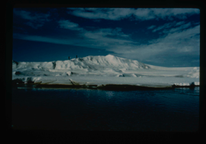
Needle ice formed on Centrum Lake with melt water drainage
Stanley Needleman
35mm slide
20th century Greenland image
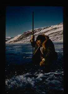
Dan Krinsley, U.S. Geological Survey, in moat developing at Centrum Lake
Stanley Needleman
35mm slide
20th century Greenland Image
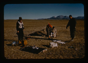
Surveying party also measures temperatures at each station on Centrum Lake.
Stanley Needleman
35mm slide
20th century Greenland Image
![Image of Count Eigil Knuth performing archaeological fieldwork on Eskimo [Inuit] tent rings](/media/Previews/1992.20_kiosk/JPEG_flipped/1992.20.166_flip.png)
Count Eigil Knuth performing archaeological fieldwork on Eskimo [Inuit] tent rings
Stanley Needleman
35mm slide
20th century Greenland Image
![Image of Count Eigil Knuth performing archaeological fieldwork on Eskimo [Inuit] tent rings](/media/Previews/1992.20_kiosk/JPEG_flipped/1992.20.167_flip.png)
Count Eigil Knuth performing archaeological fieldwork on Eskimo [Inuit] tent rings
Stanley Needleman
35mm slide
20th century Greenland Image
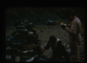
![Image of Close up view of Count Knuth investigating Eskimo [Inuit] tent ring at Centrum Lake](/media/Previews/1992.20_kiosk/JPEG_flipped/1992.20.180_flip.png)
Close up view of Count Knuth investigating Eskimo [Inuit] tent ring at Centrum Lake
Stanley Needleman
35mm slide
20th century Greenland Image
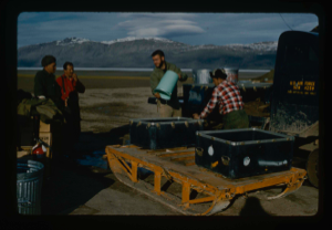
Field party checks C-130 airdrops on the delta for damage and reports results
Stanley Needleman
35mm slide
20th century Greenland Image
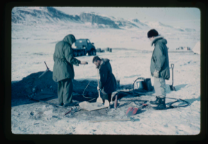
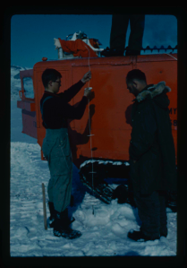
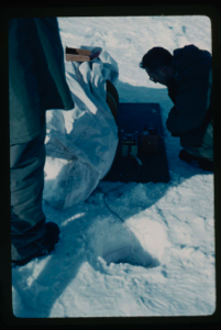
Using live steam to melt permafrost to be able to drill into the frozen zone
Stanley Needleman
35mm slide
20th century Greenland Image
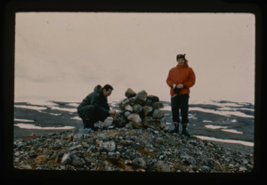
Dan Krinsley of U.S. Geological Survey and ? inspect cairn on Cape George Cohn
Stanley Needleman
35mm slide
20th century Greenland Image
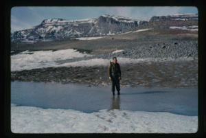
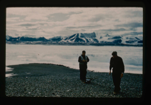
Man on limestone formation (contact with sandstone) on east-southeast Lake shore
Stanley Needleman
35mm slide
20th century Greenland Image
Operation Groundhog, 60B under Bill Davies and Dan Krinsley, leaving
Stanley Needleman
35mm slide
20th century Greenland Image
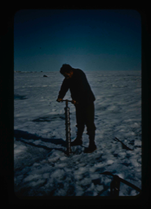
Drilling 90 drill holes through the snow and ice cover of Centrum Lake
Stanley Needleman
35mm slide
20th century Greenland Image
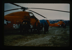
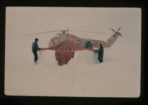
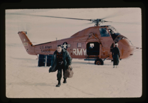
US Army helicopters staging from Cape Rasmussen and camp established on July 4
Stanley Needleman
35mm slide
20th century Greenland image
U.S. Army helicopter pilots, North Greenland coast on Arctic Ocean.
Stanley Needleman
35mm slide
20th century Greenland image
US Army helicopter pilots open cairn at Cape Morris Jesup, North Greenland.
Stanley Needleman
35mm slide
20th century Greenland image
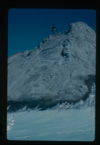
Ice ridges located off Cape Morris Jesup.
Stanley Needleman
35mm slide
20th century Greenland image
W.E. Davies, U.S.G.S. measuring terraces at Kaffeklub Island, Constable Bay
Stanley Needleman
35mm slide
20th century Greenland Image
Krinsley and 'copter pilot erecting para-igloo tent in snow by Arctic Ocean.
Stanley Needleman
35mm slide
20th century Greenland Image
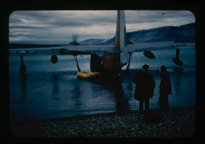
Royal Canadian Air Force C-119 made emergency wheeled landing on soil runway
Stanley Needleman
35mm slide
20th century Greenland image
Canadian C-119 aircraft landed safely in emergecy landing at Centrum strip
Stanley Needleman
35mm slide
20th century Greenland Image
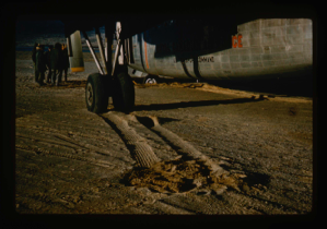
Personnel are using raft to unload SA-16 aircraft which became mired in the mud
Stanley Needleman
35mm slide
20th century Greenland Image
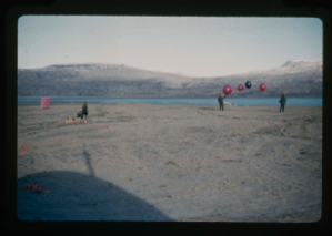
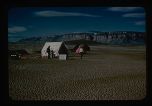
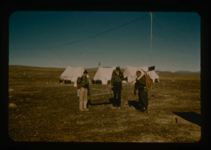
Celebrating July 4 holiday at Centrum Lake Base Camp.
Stanley Needleman
35mm slide
20th century Greenland Image
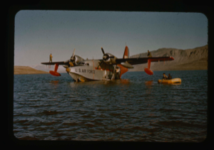
Landing on shore by SA-16; rafting personnel and equipment for Operation Group
Stanley Needleman
35mm slide
20th century Greenland image
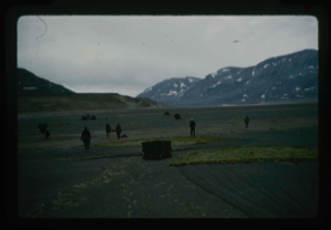
Study of soil polygons in foreground near runway site at Bronlunds Fjord site.
Stanley Needleman
35mm slide
20th century Greenland image
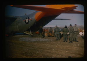
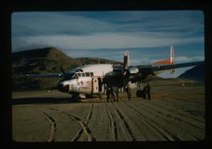
Loading of C-130 aircraft with equipment and personnel after aircraft landing
Stanley Needleman
35mm slide
20th century Greenland image
![Image of Spencer Apollonio, Bowdoin student, operates oceanographic station equipment [Actually Spencer Apollonio Class of 1955]](/media/Previews/1992.27_kiosk/JPEG_flipped/1992.27.188.png)
Installating plastic markers to measure ice thickness and loss of ice in thaw
Stanley Needleman
35mm slide
20th century Greenland Image
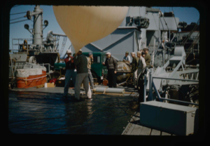
Captain of U.S.S. Atka observes launch of balloon to measure ozone layer
Stanley Needleman
35mm slide
20th century Greenland Image
Air Force scientists on U.S.S. Atka. Needleman, Wilson, Klick, Craven, Davies, ?
Stanley Needleman
35mm slide
20th century Greenland Image
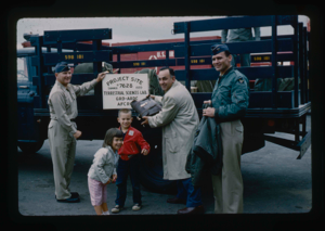
Lt. Col. Wilson holds sign for special detachment of Operation Groundhog,Thule
Stanley Needleman
35mm slide
20th century Greenland Image
View north, frozen Graeselven River. Personnel: Dr. Dan Krinsely USGS.
Stanley Needleman
35mm slide
20th century Greenland image
Testing of lake ice during melt of Centrum Lake, average thickness is 4 feet
Stanley Needleman
35mm slide
20th century Greenland image
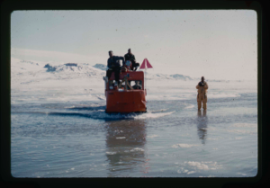
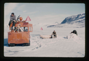
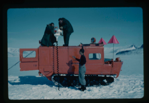
Tracked weasel transporting personnel and equipment through water and moat
Stanley Needleman
35mm slide
20th century Greenland Image
Dan Krinsley landing at ice cap base near Graeselvev River
Stanley Needleman
35mm slide
20th century Greenland Image
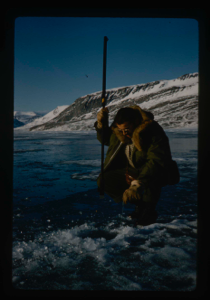
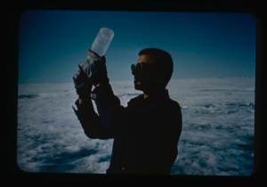
Dan Krinsley reading meter to determine temperatures at varying depths
Stanley Needleman
35mm slide
20th century Greenland Image
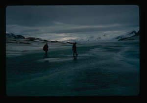
Field party under Krinsley checks extent of moat at Centrum Lake
Stanley Needleman
35mm slide
20th century Greenland Image
![Image of Count Eigil Knuth, Danish archaeologist, examining old Eskimo [Inuit] tent ring](/media/Previews/1992.27_kiosk/JPEG_flipped/1992.27.26.png)
Count Eigil Knuth, Danish archaeologist, examining old Eskimo [Inuit] tent ring
Stanley Needleman
35mm slide
20th century Greenland Image
![Image of Needleman stands amid a series of old Eskimo [Inuit] tent rings located on terrace](/media/Previews/1992.27_kiosk/JPEG_flipped/1992.27.37.png)
Needleman stands amid a series of old Eskimo [Inuit] tent rings located on terrace
Stanley Needleman
35mm slide
20th century Greenland Image
![Image of Close-up view of old Eskimo [Inuit] tent ring at Centrum Lake's northwest shore terrace.](/media/Previews/1992.27_kiosk/JPEG_flipped/1992.27.40.png)
Close-up view of old Eskimo [Inuit] tent ring at Centrum Lake's northwest shore terrace.
Stanley Needleman
35mm slide
20th century Greenland Image
Kinsella and Blackmon pour drinking water from truck to sled to flush
Stanley Needleman
35mm slide
20th century Greenland Image
Coring the snow-ice cover of the lake (Lake Peters)
Stanley Needleman
35mm slide
20th century Greenland Image
![Image of Eskimo [Inughuit] sod hut. Sgt. D. Craven, U.S.A.F. standing by](/media/Previews/1992.20_kiosk/JPEG_flipped/1992.20.12_flip.png)
Eskimo [Inughuit] sod hut. Sgt. D. Craven, U.S.A.F. standing by
Stanley Needleman
35mm slide
20th century Greenland Image
Ice coring on Ice Island T-3 (Columbia University student Isacks).
Stanley Needleman
35mm slide
20th century Arctic Ocean Image
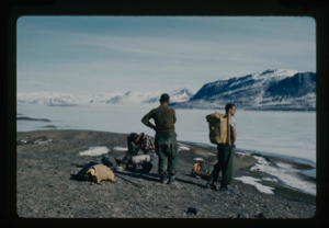
Leaving base camp at Polaris Promontory to perform soil tests. Stanley Needleman
Stanley Needleman
35mm slide
20th century Greenland Image
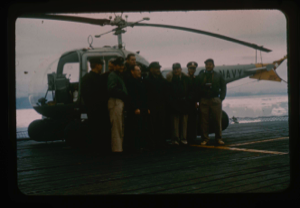
![Image of Eskimos [Inuit] from Ellesmere Island, NWT, on icebreaker U.S.S. Atka](/media/Previews/1992.20_kiosk/JPEG_flipped/1992.20.51_flip.png)
Eskimos [Inuit] from Ellesmere Island, NWT, on icebreaker U.S.S. Atka
Stanley Needleman
35mm slide
20th century Canada Image
Collecting soil samples from drilling and test pitting, Polaris Promontory
Stanley Needleman
35mm slide
20th century Greenland Image
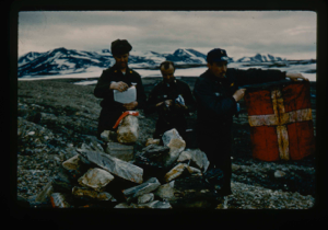
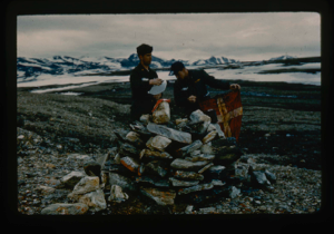
Count Eigil Knuth, archaeologist from Denmark, discussing cache sites
Stanley Needleman
35mm slide
20th century Image
Size perspective of airstrip. 5000 feet in length plus overrun areas.
Stanley Needleman
35mm slide
20th century Greenland Image
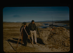
Surveying by theodolite at Polaris Promontory and tying into BBC Greenwich time
Stanley Needleman
35mm slide
20th century Greenland Image
Davies and helicopter pilot examine cairn left on Polaris Bay shore.
Stanley Needleman
35mm slide
20th century Greenland Image
Your current search criteria is: Keyword is "CKA" and [Objects]Period is ".
View current selection of records as: