
 by Artist (3)
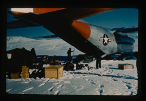 Stanley Needleman Operation Groundhog Photographic Collection
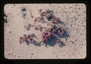
Desert vegetation at Centrum Lake.
Stanley Needleman
35mm slide
20th century Greenland Image

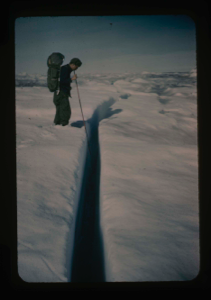
Survey of runway at Polaris Promontory using radio receiver. Wilson & Davies
Stanley Needleman
35mm slide
20th century Greenland Image
Debris and large rock on T-3 ice island, Arctic Ocean. Cabaniss is geologist
Stanley Needleman
35mm slide
20th century Arctic Ocean Image
Lake Peters near Thule AFB study to determine if lake ice can support aircraft
Stanley Needleman
35mm slide
20th century Greenland Image
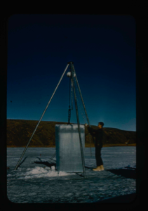
Cabaniss removing block of ice cut from Lake for strength tests
Stanley Needleman
35mm slide
20th century Greenland Image
Cabaniss examines hinge crack between ice island T-3 and pack ice
Stanley Needleman
35mm slide
20th century Arctic Ocean Image
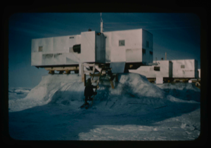
Ice pedestals formed beneath trailers on Ice Island T-3 due to extreme ablation
Stanley Needleman
35mm slide
20th century Arctic Ocean Image
![Image of [Spencer Apollonio, Bowdoin graduate, on] Ice Island T-3 observing east end of island](/media/Previews/1992.27_kiosk/JPEG_flipped/1992.27.150.png)
[Spencer Apollonio, Bowdoin graduate, on] Ice Island T-3 observing east end of island
Stanley Needleman
35mm slide
20th century Arctic Ocean Image
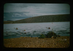
![Image of Ice hummocks on lake [Centrum?]. Equipment in foreground](/media/Previews/1992.27_kiosk/JPEG_flipped/1992.27.151.png)
Ice hummocks on lake [Centrum?]. Equipment in foreground
Stanley Needleman
35mm slide
20th century Greenland image
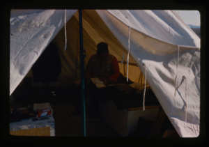
Davies USGS completing field notes in sleeping tent at Polaris Promontory Site.
Stanley Needleman
35mm slide
20th century Greenland Image
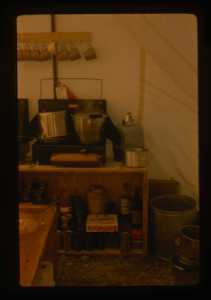
View of well-organized kitchen section of tent.
Stanley Needleman
35mm slide
20th century Greenland Image
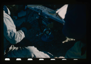
Close-up of engineering test to determine bearing strength of surface using jeep
Stanley Needleman
35mm slide
20th century Greenland Image
Your current search criteria is: Portfolio is "Stanley Needleman Operation Groundhog Photographic Collection".
View current selection of records as: