
 by Artist (11)
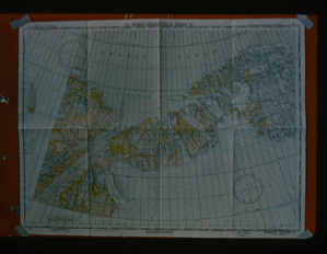
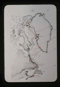
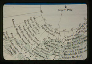
Map of Robeson Channel indicating all areas along North Greenland coast
Stanley Needleman
35mm slide
20th century Greenland image
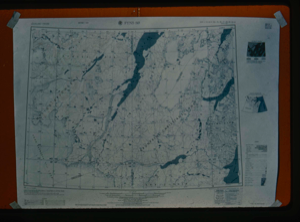
Map of Centrum Lake, Northeast Greenland.
Stanley Needleman
35mm slide
20th century Greenland Image
Air Force Arctic Terrain Research Program, Research and Development, Hanscom Bas
Stanley Needleman
35mm slide
20th century United States image
![Image of Surveying of base camp into areal [sp?] map of Centrum Lake area](/media/Previews/1992.27_kiosk/JPEG_flipped/1992.27.35.png)
Surveying of base camp into areal [sp?] map of Centrum Lake area
Stanley Needleman
35mm slide
20th century Greenland Image
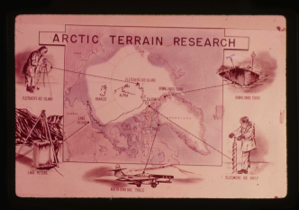
Top of the world map showing regions and sites explored by USAF
Stanley Needleman
35mm slide
20th century Greenland Image
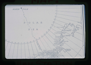
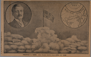
Map: Peary Route to North Pole
Unidentified Artist
35mm slide
20th century Image
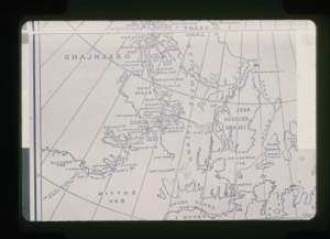
Map: MacMillan Station area (1908-09) Northwest Greenland
Unidentified Artist
35mm slide
20th century Image
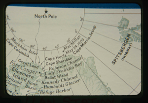
Map: Cape Morris Jesup
Unidentified Artist
35mm slide
20th century Image
Map: MacMillan routes, Nova Scotia to Greenland (2 copies)
Rutherford Platt
35mm slide
20th century Image
Map: Crocker Land area
Unidentified Artist
35mm slide
20th century Image
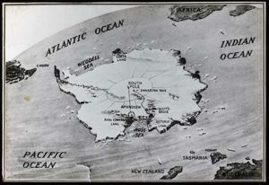
Antarctica, Map
Donald Baxter MacMillan
silver gelatin on glass
image
Your current search criteria is: Keyword is "BQX".
View current selection of records as: