
 by Country (4)
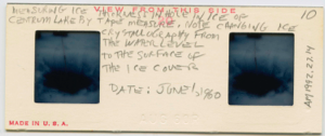
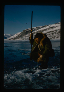
Measuring ice thickness by tape measure in hole in ice of Centrum Lake
Stanley Needleman
stereo transparency
20th century Greenland Image
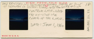
Dan Krinsley, USGS, stands at point of drainage of Saefaxi River into lake
Stanley Needleman
stereo transparency
20th century Greenland Image
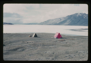
Camp site on north shore of Centrum Lake, moat starting at edge of lake.
Stanley Needleman
35mm slide
20th century Greenland image
Needle ice formed on Centrum Lake with melt water drainage
Stanley Needleman
35mm slide
20th century Greenland image
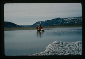
Weasel sled carrying chunks of ice from Lake to be used for drinking water
Stanley Needleman
35mm slide
20th century Greenland Image

U.S.S. Atka anchored at edge of pack ice near Thule AFB.
Stanley Needleman
35mm slide
20th century Greenland Image
View north, frozen Graeselven River. Personnel: Dr. Dan Krinsely USGS.
Stanley Needleman
35mm slide
20th century Greenland image
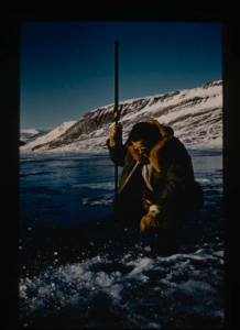
Testing of lake ice during melt of Centrum Lake, average thickness is 4 feet
Stanley Needleman
35mm slide
20th century Greenland image
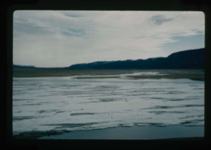
View of Grassrig (Graeselven) River toward Greenland Ice Cap. Ice still in lake
Stanley Needleman
35mm slide
20th century Greenland image
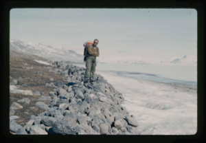
Frank Maher standing on gravel pushed by Centrum Lake ice onto northwest shore.
Stanley Needleman
35mm slide
20th century Greenland Image
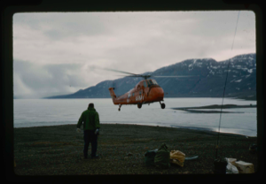
Army helicopter H-34 picks up Needleman from Centum Lake. Ice still on lake
Stanley Needleman
35mm slide
20th century Greenland image
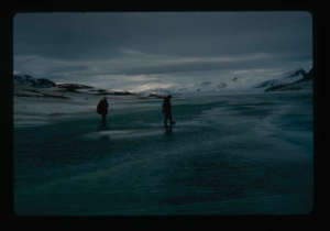
Centrum Lake moat is widening. Frank Maher is probing the safety of ice
Stanley Needleman
stereo transparency
20th century Greenland Image
Your current search criteria is: Keyword is "CIU" and [Objects]Display Artist is "Stanley Needleman".
View current selection of records as: