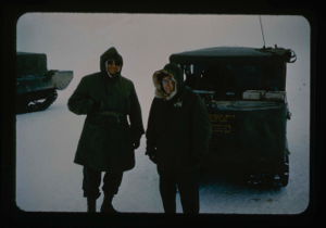
Needleman and Davies on Greenland Ice Cap during a storm whiteout condition.
Stanley Needleman
35mm slide
20th century Greenland Image
Davies stakes 5-man tent with aid of boulders to protect against storms, wind
Stanley Needleman
35mm slide
20th century Greenland Image
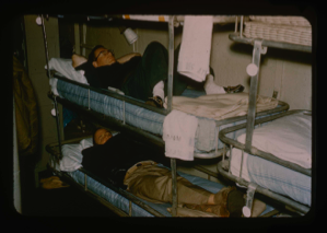
Davies resting in bunk aboard the USS Atka prior to evening meal at Thule.
Stanley Needleman
35mm slide
20th century Greenland Image
Davies and Capt. Klick discuss ice conditions north of Thule AFB on the USS Atka
Stanley Needleman
35mm slide
20th century Greenland Image
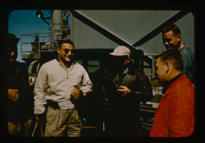
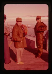
Project Leader Needleman discusses projects with skipper of USS Atka and team
Stanley Needleman
35mm slide
20th century Greenland Image

Survey of runway at Polaris Promontory using radio receiver. Wilson & Davies
Stanley Needleman
35mm slide
20th century Greenland Image
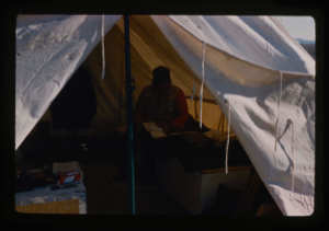
Davies USGS completing field notes in sleeping tent at Polaris Promontory Site.
Stanley Needleman
35mm slide
20th century Greenland Image
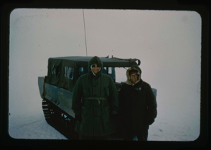
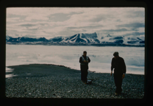
William E. Davies USGS and Stan Needleman USAF, leader of Operation Groundhog
Stanley Needleman
35mm slide
20th century Greenland image
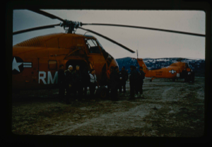
Operation Groundhog, 60B under Bill Davies and Dan Krinsley, leaving
Stanley Needleman
35mm slide
20th century Greenland Image
![Image of [Peary's] Cairn at Cape Morris Jesup. Dr. William E. Davies, Geologist](/media/Previews/1992.19_kiosk/JPEG_flipped/1992.19.18_flip.png)
[Peary's] Cairn at Cape Morris Jesup. Dr. William E. Davies, Geologist
Stanley Needleman
35mm slide
20th century Greenland image
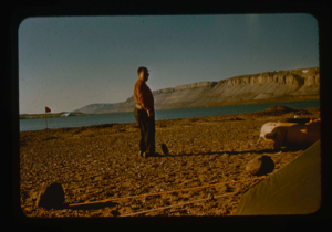
W.E. Davies, U.S.G.S. measuring terraces at Kaffeklub Island, Constable Bay
Stanley Needleman
35mm slide
20th century Greenland Image
![Image of View of para-igloo [iglu] tent, housing 4 persons plus equipment.](/media/Previews/1992.20_kiosk/JPEG_flipped/1992.20.103_flip.png)
View of para-igloo [iglu] tent, housing 4 persons plus equipment.
Stanley Needleman
35mm slide
20th century Greenland Image
Your current search criteria is: Keyword is "DCU".
View current selection of records as: