US Army helicopters, base camp at Bronlunds Fjord. Ice on fjord in background
Stanley Needleman
35mm slide
20th century Greenland image
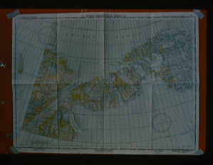
Map of Robeson Channel indicating all areas along North Greenland coast
Stanley Needleman
35mm slide
20th century Greenland image
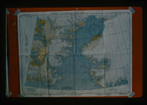
View of Smith Sound World Aeronautical Chart to show areas of investigation
Stanley Needleman
35mm slide
20th century Greenland image
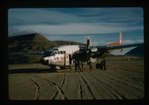
Royal Canadian Air Force C-119 made emergency wheeled landing on soil runway
Stanley Needleman
35mm slide
20th century Greenland image
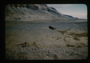
Lone musk ox bull cast out by herd near upper terrace of Bronlunds Fjord.
Stanley Needleman
35mm slide
20th century Greenland image
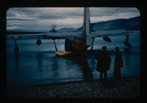
Landing on shore by SA-16; rafting personnel and equipment for Operation Group
Stanley Needleman
35mm slide
20th century Greenland image
Study of soil polygons in foreground near runway site at Bronlunds Fjord site.
Stanley Needleman
35mm slide
20th century Greenland image
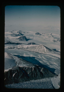
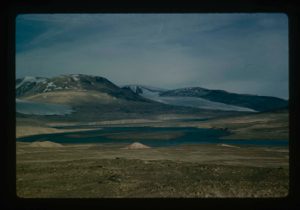
Nunataks of Peary Land, North Greenland. View toward ice cap.
Stanley Needleman
35mm slide
20th century Greenland image
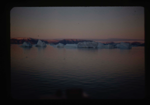
North of area surrounding natural runway, Bronlunds Fjord. Icebergs beyond
Stanley Needleman
35mm slide
20th century Greenland image
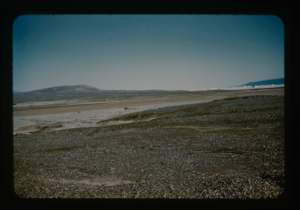
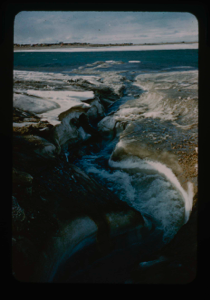
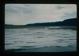
View of raised delta in dry state.
Stanley Needleman
35mm slide
20th century Greenland image
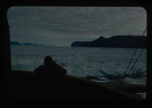
Enroute - Thule AFB to Polaris Promontory by icebreaker U.S.S. ATKA
Stanley Needleman
35mm slide
20th century Greenland image
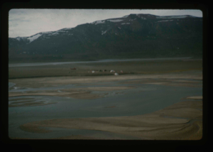
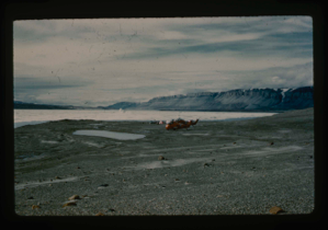
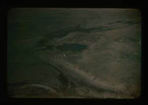
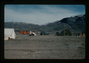
Aerial view of Centrum Lake base camp with US Army helicopters. Saefaxi River
Stanley Needleman
35mm slide
20th century Greenland image
Soils engineering tests on runway at Polaris Promontory.
Stanley Needleman
35mm slide
20th century Greenland image
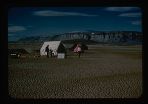
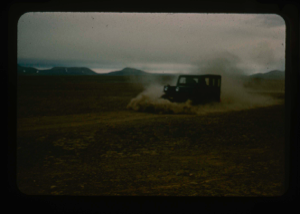
Advance party of US Army Ice Cap Expedition (Lead Dog Operation)
Stanley Needleman
35mm slide
20th century Greenland image
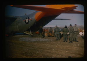
Loading of C-130 aircraft with equipment and personnel after aircraft landing
Stanley Needleman
35mm slide
20th century Greenland image
US Army Lead Dog Expedition on a surface operation on Greenland Ice Cap
Stanley Needleman
35mm slide
20th century Greenland image
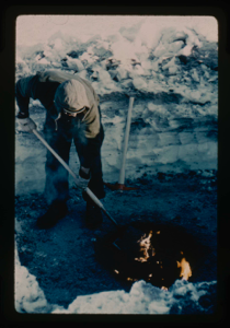
Digging in permafrost at Centrum Lake, snow cover of 2 ft. Use of oil fire to m
Stanley Needleman
35mm slide
20th century Greenland image
Drainage from terrace into Centrum Lake; snow cover still on terrace.
Stanley Needleman
35mm slide
20th century Greenland image
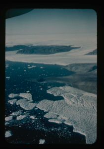
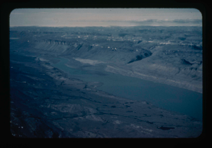
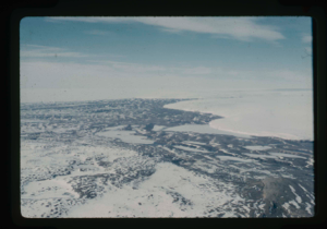
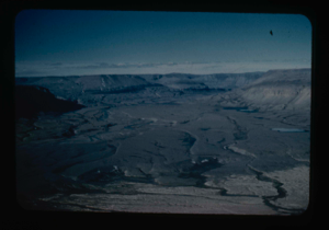
View of Bronlunds Fjord from the air. Note floating icebergs.
Stanley Needleman
35mm slide
20th century Greenland image
Measuring depth and contour of Centrum Lake by dropped weight on cable
Stanley Needleman
35mm slide
20th century Greenland image
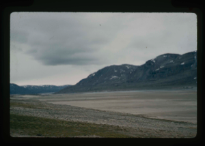
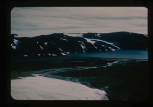
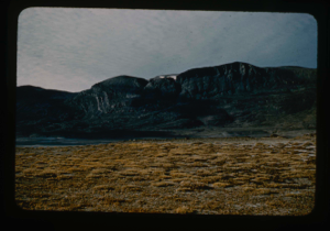
View of Bronlunds Fjord area. View toward ice cap.
Stanley Needleman
35mm slide
20th century Greenland image
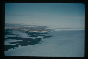
View of main Greenland ice cap and access route
Stanley Needleman
35mm slide
20th century Greenland image
View north, frozen Graeselven River. Personnel: Dr. Dan Krinsely USGS.
Stanley Needleman
35mm slide
20th century Greenland image
Testing of lake ice during melt of Centrum Lake, average thickness is 4 feet
Stanley Needleman
35mm slide
20th century Greenland image
Edge of Greenland Ice Cap in Peary Land. Locating a suitable access route down
Stanley Needleman
35mm slide
20th century Greenland image
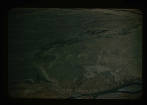
Drainage of high areas into Centrum Lake.
Stanley Needleman
35mm slide
20th century Greenland image
Grassrig (Graeselven) River winding back to ice cap.
Stanley Needleman
35mm slide
20th century Greenland image
Edge of Greenland Ice Cap in Peary Land. Searching for access to Centrum Lake
Stanley Needleman
35mm slide
20th century Greenland image
View of Grassrig (Graeselven) River toward Greenland Ice Cap. Ice still in lake
Stanley Needleman
35mm slide
20th century Greenland image
![Image of Independence Fjord and glaciers flowing adjacent to Bronlunds Fjord [aerial]](/media/Previews/1992.19_kiosk/JPEG_flipped/1992.19.111_flip.png)
Independence Fjord and glaciers flowing adjacent to Bronlunds Fjord [aerial]
Stanley Needleman
35mm slide
20th century Greenland image
![Image of Independence Fjord intersects Bronlunds Fjord, glaciers and fjord ice [aerial]](/media/Previews/1992.19_kiosk/JPEG_flipped/1992.19.112_flip.png)
Independence Fjord intersects Bronlunds Fjord, glaciers and fjord ice [aerial]
Stanley Needleman
35mm slide
20th century Greenland image
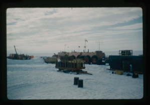
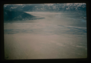
Aerial view of runway area on Polaris Promontory. Tents in lower left
Stanley Needleman
35mm slide
20th century Greenland image
View north of Saefaxi River draining into Centrum Lake. Raised delta
Stanley Needleman
35mm slide
20th century Greenland image
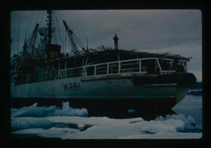
Icebreaker USCG Westwind, lands Air Force research team plus equipment by LCVP
Stanley Needleman
35mm slide
20th century Greenland image
Landing barge from the icebreaker to Polaris Promontory beach. Required skirting
Stanley Needleman
35mm slide
20th century Greenland image
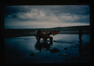
Tractor crossing on Polaris Promontory. Duckboards were used to ford the rivers.
Stanley Needleman
35mm slide
20th century Greenland image
Aerial view at lower altitude of runway area on Polaris Promontory.
Stanley Needleman
35mm slide
20th century Greenland image
Light grading of runway microrelief on Polaris Promontory.
Stanley Needleman
35mm slide
20th century Greenland image

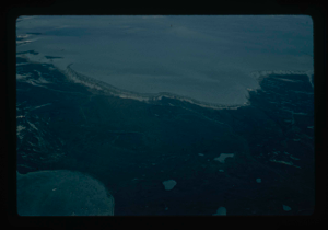
Completed natural runway on Polaris Promontory. Red flags mark path
Stanley Needleman
35mm slide
20th century Greenland image
River valleys draining Greenland Ice Cap and flowing into Centrum Lake.
Stanley Needleman
35mm slide
20th century Greenland image
Tussocks on raised delta at Centrum Lake.
Stanley Needleman
35mm slide
20th century Greenland image
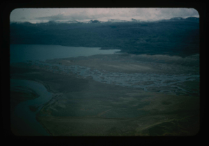
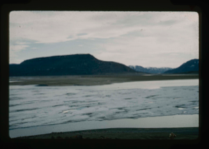
Aeril view of Centrum Lake and raised delta and Saefaxi River
Stanley Needleman
35mm slide
20th century Greenland image
View north toward Greenland Ice Cap.
Stanley Needleman
35mm slide
20th century Greenland image
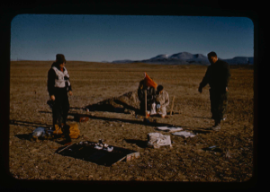
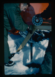
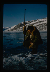
Testing bearing strength at Centrum Lake - proving ring model
Stanley Needleman
35mm slide
20th century Greenland image
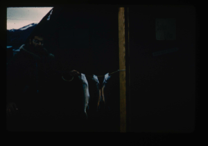
Arctic char caught in Centrum Lake. Many fish caught in only 3 weeks
Stanley Needleman
35mm slide
20th century Greenland image
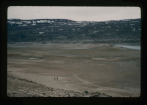
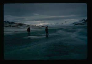
View of raised delta, Centrum Lake. 2 men exploring orientation of runway
Stanley Needleman
35mm slide
20th century Greenland image
View of raised delta from moat on Centrum Lake. Some ice still floating in lake
Stanley Needleman
35mm slide
20th century Greenland image
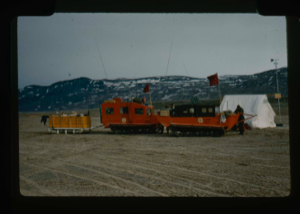
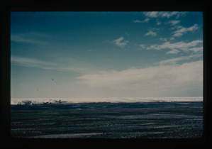
Centrum Lake base camp including 2 US helicopters and vehicles.
Stanley Needleman
35mm slide
20th century Greenland image
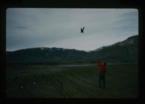
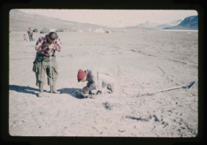
Jaeger birds eating thrown bits of food at base camp.
Stanley Needleman
35mm slide
20th century Greenland image
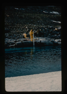
Using lake gauge to measure water depth at shoreline on Centrum Lake.
Stanley Needleman
35mm slide
20th century Greenland image
Your current search criteria is: Acquisition is "Stanley Needleman Collection, 1" and [Objects]Nationality is "Greenland".
View current selection of records as: