 Stanley Needleman Operation Groundhog Photographic Collection
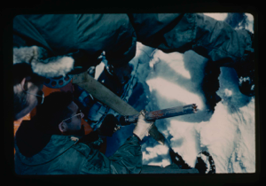
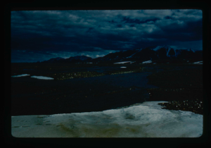
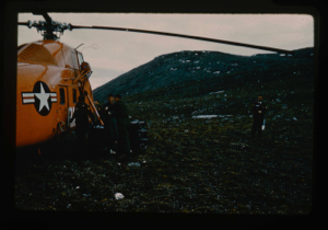
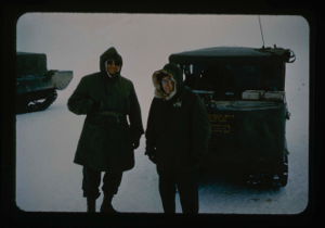
U.S. Army helicopter pilots, North Greenland coast on Arctic Ocean.
Stanley Needleman
35mm slide
20th century Greenland image
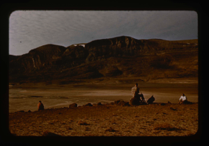
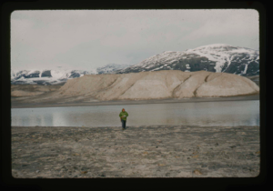
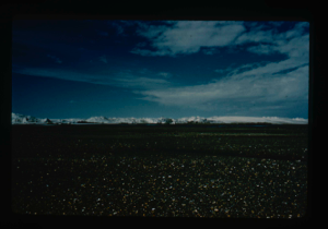
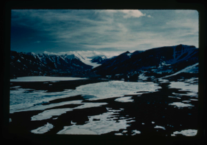
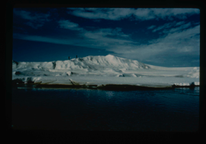
Centrum Lake.
Stanley Needleman
35mm slide
20th century Greenland image
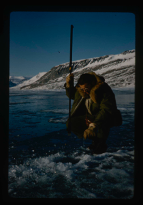
Measurement of lake ice thickness. Stan Needleman, USAF, and Al Maher
Stanley Needleman
35mm slide
20th century Greenland image
Drilling 90 holes in lake ice cover to determine thickness. Stan Needleman
Stanley Needleman
35mm slide
20th century Greenland image
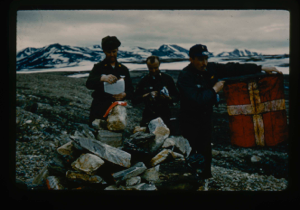
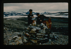
![Image of [Peary's] Cairn at Cape Morris Jesup. Dr. William E. Davies, Geologist](/media/Previews/1992.19_kiosk/JPEG_flipped/1992.19.18_flip.png)
[Peary's] Cairn at Cape Morris Jesup. Dr. William E. Davies, Geologist
Stanley Needleman
35mm slide
20th century Greenland image
Sampling bottom sediments of Centrum Lake. Dr. Daniel B. Krinsely
Stanley Needleman
35mm slide
20th century Greenland image
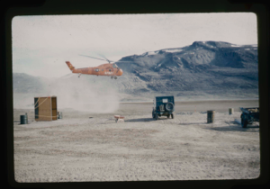
US Army helicopters based at Centrum Lake.
Stanley Needleman
35mm slide
20th century Greenland image
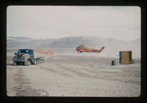
U.S. Army helicopters based at Centrum Lake.
Stanley Needleman
35mm slide
20th century Greenland image
Geological reconnaissance near Centrum Lake. Stan Needleman USAF
Stanley Needleman
35mm slide
20th century Greenland image
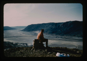
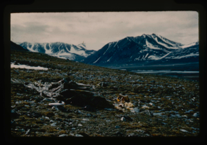
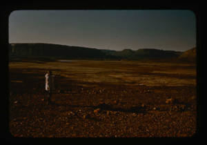
Geological reconnaissance of Centrum Lake area about 20 miles from ice cap
Stanley Needleman
35mm slide
20th century Greenland image
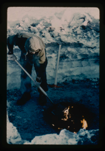
Digging in permafrost at Centrum Lake, snow cover of 2 ft. Use of oil fire to m
Stanley Needleman
35mm slide
20th century Greenland image
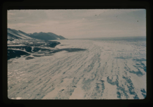
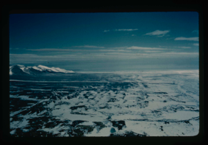
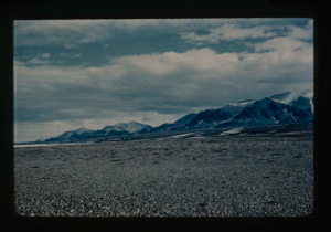
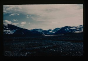
View of main Greenland ice cap and access route
Stanley Needleman
35mm slide
20th century Greenland image
North shore of thawed out Centrum Lake. 265 ft. average depth.
Stanley Needleman
35mm slide
20th century Greenland image
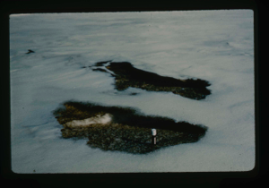
Bare or thawed out spots in snow cover of Centrum Lake terrace.
Stanley Needleman
35mm slide
20th century Greenland image
Drainage from terrace into Centrum Lake; snow cover still on terrace.
Stanley Needleman
35mm slide
20th century Greenland image
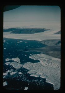
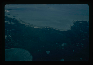
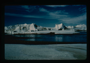
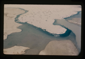
View of Bronlunds Fjord from the air. Note floating icebergs.
Stanley Needleman
35mm slide
20th century Greenland image
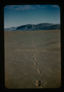
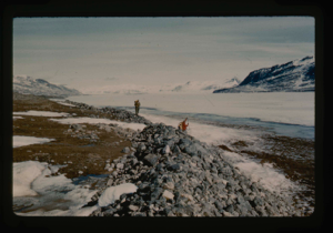
Terrace of Centrum Lake, NE Greenland. Note footprints in loose sand.
Stanley Needleman
35mm slide
20th century Greenland image
View east, Arctic Ocean in frozen state at shore of Cape Morris Jesup
Stanley Needleman
35mm slide
20th century Greenland image
View south toward Greenland Ice Cap, terrace at Cape Morris Jesup.
Stanley Needleman
35mm slide
20th century Greenland image
View west of Cape Morris Jesup - Arctic coast - note terrace of the cape
Stanley Needleman
35mm slide
20th century Greenland image
North coast of Greenland above Cape Bridgeman, Arctic Ocean coastline.
Stanley Needleman
35mm slide
20th century Greenland image
Closeup of Cape Bridgeman area, North Greenland coast on Arctic Ocean.
Stanley Needleman
35mm slide
20th century Greenland image
Food cache air dropped on Cape Morris Jesup with parachute cover.
Stanley Needleman
35mm slide
20th century Greenland image
View west, Cape Morris Jesup. Cache site.
Stanley Needleman
35mm slide
20th century Greenland image
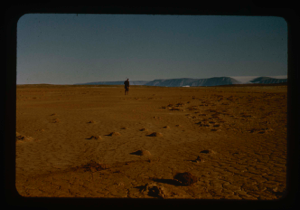
Cape Morris Jesup, North Greenland. Terrace.
Stanley Needleman
35mm slide
20th century Greenland image
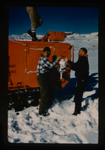
US Army helicopter pilots open cairn at Cape Morris Jesup, North Greenland.
Stanley Needleman
35mm slide
20th century Greenland image
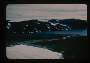
View north of Saefaxi River draining into Centrum Lake. Raised delta
Stanley Needleman
35mm slide
20th century Greenland image
View south at Cape Morris Jesup
Stanley Needleman
35mm slide
20th century Greenland image
View east at Cape Morris Jesup
Stanley Needleman
35mm slide
20th century Greenland image
View southwest at Cape Morris Jesup
Stanley Needleman
35mm slide
20th century Greenland image
View north, frozen Graeselven River. Personnel: Dr. Dan Krinsely USGS.
Stanley Needleman
35mm slide
20th century Greenland image
Testing of lake ice during melt of Centrum Lake, average thickness is 4 feet
Stanley Needleman
35mm slide
20th century Greenland image
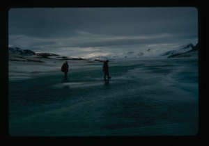
Lake ice melting
Stanley Needleman
35mm slide
20th century Greenland image
River valleys draining Greenland Ice Cap and flowing into Centrum Lake.
Stanley Needleman
35mm slide
20th century Greenland image
Tussocks on raised delta at Centrum Lake.
Stanley Needleman
35mm slide
20th century Greenland image
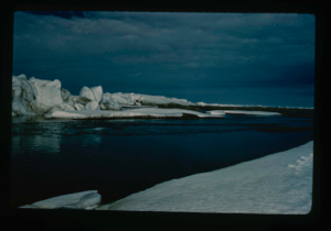
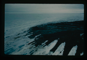
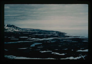
Ice ridges off Cape Morris Jesup, North Greenland coast. Arctic Ocean coastline.
Stanley Needleman
35mm slide
20th century Greenland image
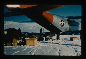
Refueling helicopters from caches at Cape Morris Jesup, North Greenland
Stanley Needleman
35mm slide
20th century Greenland image
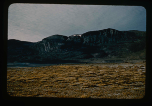
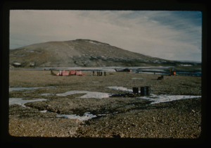
Cape Morris Jesup Valley. View southeast
Stanley Needleman
35mm slide
20th century Greenland image
Lt. Col. Robert H. Wilson USAF, points to selected emergency aircraft runway
Stanley Needleman
35mm slide
20th century Greenland image
Melting of snow on raised delta. Sublimation in site.
Stanley Needleman
35mm slide
20th century Greenland image
Melting of ice formed into needle ice
Stanley Needleman
35mm slide
20th century Greenland image
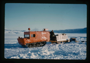
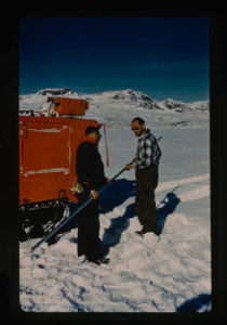
Weasel with sled as prime transport and surveying vehicle from Centrum Lake
Stanley Needleman
35mm slide
20th century Greenland image
Ice ridges located off Cape Morris Jesup.
Stanley Needleman
35mm slide
20th century Greenland image
US Army helicopters staging from Cape Rasmussen and camp established on July 4
Stanley Needleman
35mm slide
20th century Greenland image
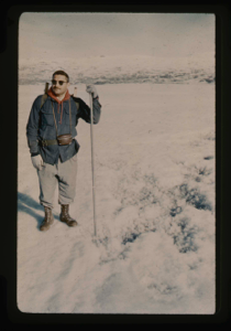
William E. Davies USGS and Stan Needleman USAF, leader of Operation Groundhog
Stanley Needleman
35mm slide
20th century Greenland image
View of raised delta, terrace at Centrum Lake. Note tussocks of vegetation
Stanley Needleman
35mm slide
20th century Greenland image
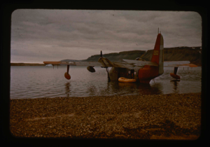
Access to Bronlunds Fjord runway site by SA-16 amphibian aircraft, USAF and raft
Stanley Needleman
35mm slide
20th century Greenland image
Close-up view of Cape Morris Jesup, aerial
Stanley Needleman
35mm slide
20th century Greenland image
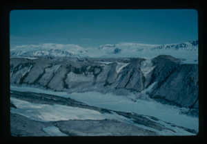
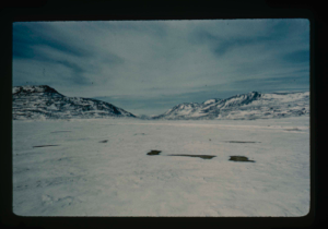
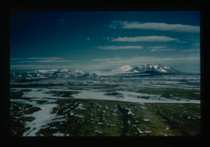
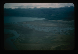
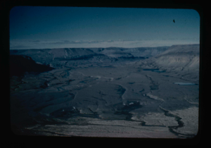
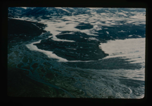
Aerial view of Centrum Lake area
Stanley Needleman
35mm slide
20th century Greenland image
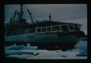
Icebreaker USCG Westwind, lands Air Force research team plus equipment by LCVP
Stanley Needleman
35mm slide
20th century Greenland image
Your current search criteria is: Portfolio is "Stanley Needleman Operation Groundhog Photographic Collection" and [Objects]Nationality is "Greenland".
View current selection of records as: