
 by Country (5)
 Stanley Needleman Operation Groundhog Photographic Collection
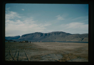
View northwest, Centrum Lake airstrip midpoint, base camp west of touchdown
Stanley Needleman
35mm slide
20th century Greenland Image
View of base camp and radio antenna at Polaris Promontory.
Stanley Needleman
35mm slide
20th century Greenland Image
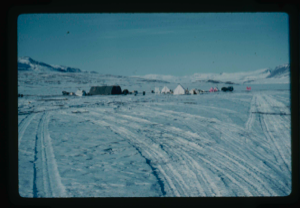
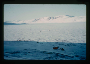
View of base camp at Centrum Lake with snow cover 2 feet. NE Greenland
Stanley Needleman
35mm slide
20th century Greenland Image
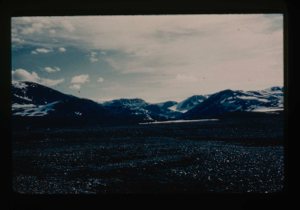
View of Bronlunds Fjord area. View toward ice cap.
Stanley Needleman
35mm slide
20th century Greenland image
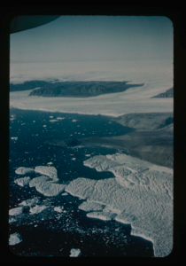
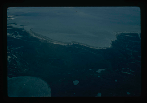
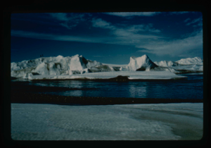
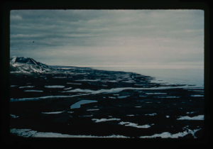
View of Bronlunds Fjord from the air. Note floating icebergs.
Stanley Needleman
35mm slide
20th century Greenland image
View of Bronlunds Fjord natural runway site looking south
Stanley Needleman
35mm slide
20th century Greenland image
View of Cape Morris Jesup, view south. Arctic Ocean is in the foreground (Sykes)
Stanley Needleman
35mm slide
20th century Greenland Image
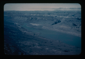
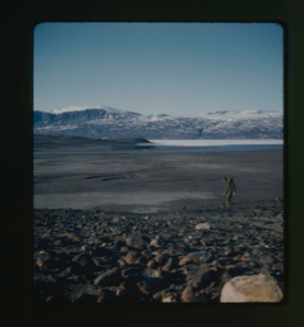
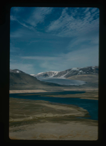
View of Centrum Lake to ice cap at south end. Peary Land (R.Sykes)
Stanley Needleman
35mm slide
20th century Greenland Image
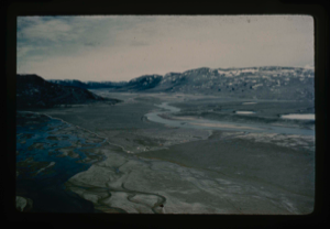
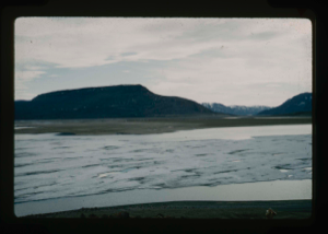
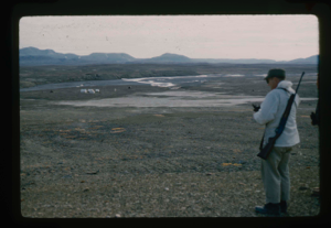
View of delta, west-northwest, Centrum Lake, Graeselv River - braided stream
Stanley Needleman
35mm slide
20th century Greenland Image
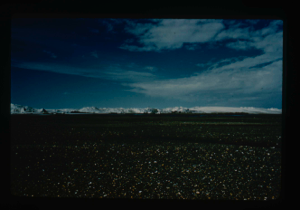
View of Grassrig (Graeselven) River toward Greenland Ice Cap. Ice still in lake
Stanley Needleman
35mm slide
20th century Greenland image
View of Independence Fjord, Peary Land.
Stanley Needleman
35mm slide
20th century United States image
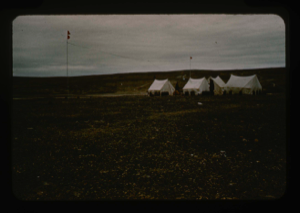
View of kitchen tent, Polaris Promontory
Stanley Needleman
35mm slide
20th century Greenland Image
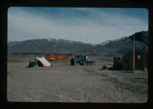
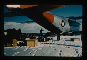
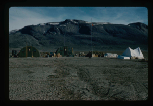
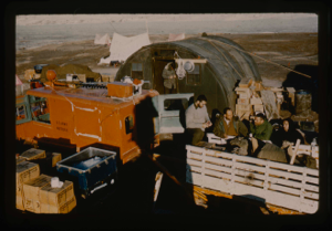
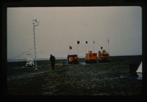
View of logistics vehicles at base camp, 2 U.S. Army helicopters, large tracked
Stanley Needleman
35mm slide
20th century Greenland Image
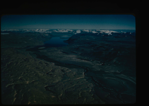
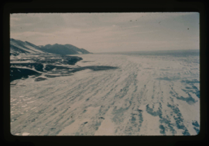
View of main Greenland ice cap and access route
Stanley Needleman
35mm slide
20th century Greenland image
![Image of View of para-igloo [iglu] tent, housing 4 persons plus equipment.](/media/Previews/1992.20_kiosk/JPEG_flipped/1992.20.103_flip.png)
View of para-igloo [iglu] tent, housing 4 persons plus equipment.
Stanley Needleman
35mm slide
20th century Greenland Image
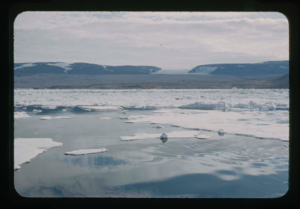
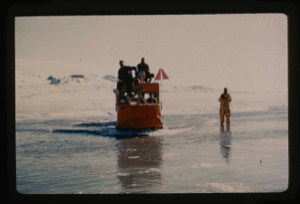
View of Polaris Bay from the landing barge of the USS Atka. Note ice field
Stanley Needleman
35mm slide
20th century Greenland Image
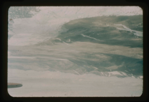
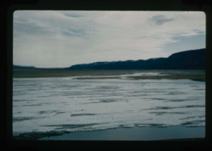
View of raised delta from moat on Centrum Lake. Some ice still floating in lake
Stanley Needleman
35mm slide
20th century Greenland image
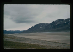
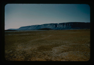
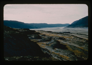
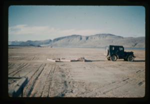
View of raised delta in dry state.
Stanley Needleman
35mm slide
20th century Greenland image
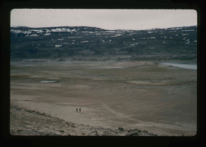
View of raised delta, Centrum Lake. 2 men exploring orientation of runway
Stanley Needleman
35mm slide
20th century Greenland image
View of raised delta, terrace at Centrum Lake. Note tussocks of vegetation
Stanley Needleman
35mm slide
20th century Greenland image
View of runway on Polaris Promontory. Note base camp at Graystone River
Stanley Needleman
35mm slide
20th century Greenland Image
View of Saefaxi River valley to the high terraces back to the Greenland Ice Cap.
Stanley Needleman
35mm slide
20th century Greenland Image
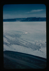
View of small snow mounds along centerline of runway on delta at Centrum Lake.
Stanley Needleman
35mm slide
20th century Greenland Image
View of Smith Sound World Aeronautical Chart to show areas of investigation
Stanley Needleman
35mm slide
20th century Greenland image
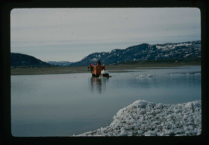
View of weasel and sled on Centrum Lake which has a snow and ice cover.
Stanley Needleman
35mm slide
20th century Greenland Image
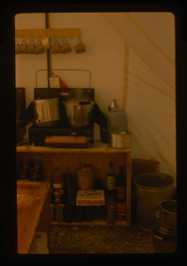
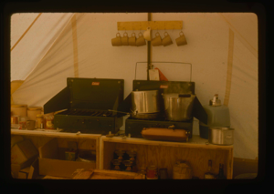
View of well-organized kitchen section of tent.
Stanley Needleman
35mm slide
20th century Greenland Image
View south at Cape Morris Jesup
Stanley Needleman
35mm slide
20th century Greenland image
View south of Graystone River (Graasten Elv) and base camp at Polaris Promontory
Stanley Needleman
35mm slide
20th century Greenland Image
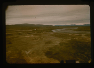
View south to flood plain and Saefaxi River draining into Centrum Lake. Corp
Stanley Needleman
stereo transparency
20th century Greenland Image
View south toward Greenland Ice Cap, terrace at Cape Morris Jesup.
Stanley Needleman
35mm slide
20th century Greenland image
View southwest at Cape Morris Jesup
Stanley Needleman
35mm slide
20th century Greenland image
View west of Cape Morris Jesup - Arctic coast - note terrace of the cape
Stanley Needleman
35mm slide
20th century Greenland image
View west of Centrum Lake Base Camp. Radio antennas and moist soil
Stanley Needleman
35mm slide
20th century Greenland Image
View west of Saefaxi River, delta on left. Note soils polygons and damp surface.
Stanley Needleman
35mm slide
20th century Greenland Image
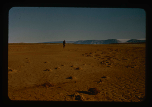
View west, Cape Morris Jesup. Cache site.
Stanley Needleman
35mm slide
20th century Greenland image
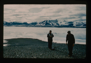
W.E. Davies, U.S.G.S. measuring terraces at Kaffeklub Island, Constable Bay
Stanley Needleman
35mm slide
20th century Greenland Image
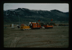
Weasel and trailer loaded for base station to conduct tests on Centrum Lake
Stanley Needleman
35mm slide
20th century Greenland Image
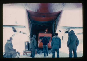
Weasel being unloaded from C-130 aircraft on lake of snow-ice cover
Stanley Needleman
35mm slide
20th century Greenland Image
Weasel sled carrying chunks of ice from Lake to be used for drinking water
Stanley Needleman
35mm slide
20th century Greenland Image
Weasel tows sled with snow-ice supply from ice pits in Centrum Lake for water
Stanley Needleman
35mm slide
20th century Greenland Image

Weasel transporting equipment and supplies from cache on Centrum Lake.
Stanley Needleman
35mm slide
20th century Greenland Image
Weasel transporting survey party back to base camp at Centrum Lake through snow,
Stanley Needleman
35mm slide
20th century Greenland image
Weasel Vehicle Group arrives at Centrum Lake base from ice cap expedition
Stanley Needleman
35mm slide
20th century Greenland Image
Weasel vehicle group at Centrum Lake Base that originated on ice cap
Stanley Needleman
35mm slide
20th century Greenland Image
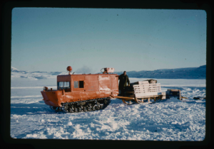
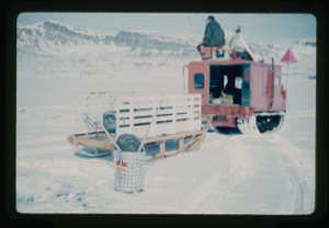
Weasel with sled as prime transport and surveying vehicle from Centrum Lake
Stanley Needleman
35mm slide
20th century Greenland image
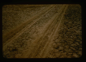
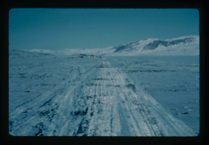
Wheel ruts on runway surface.
Stanley Needleman
35mm slide
20th century Greenland Image
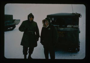
William E. Davies USGS and Stan Needleman USAF, leader of Operation Groundhog
Stanley Needleman
35mm slide
20th century Greenland image
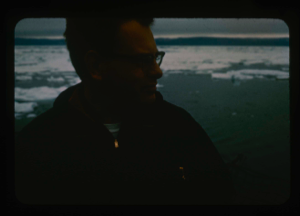
William E. Davies, Geologist-Civil Engineer, U.S. Geological Society
Stanley Needleman
35mm slide
20th century Greenland Image
Wooden drag weighted with 5 gal cans of water and rock to grade runway
Stanley Needleman
35mm slide
20th century Greenland Image
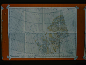
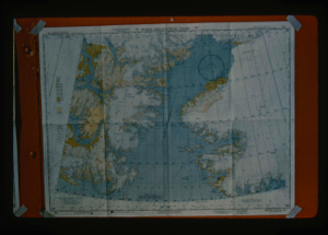
World aeronautical chart covering Independence Fjord area northeast Greenland.
Stanley Needleman
35mm slide
20th century Greenland Image
Your current search criteria is: Portfolio is "Stanley Needleman Operation Groundhog Photographic Collection" and [Objects]Display Artist is "Stanley Needleman".
View current selection of records as: