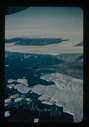
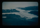
Sael So. (Seal Sea). (R. Sykes)
Nunataks of Peary Land, North Greenland. View toward ice cap.
Aerial view of Centrum Lake base camp with US Army helicopters. Saefaxi River
View of Bronlunds Fjord from the air. Note floating icebergs.
View of Bronlunds Fjord area. View toward ice cap.
Aerial view of Danmarks Fjord.
Bronlunds Fjord, Cape Harald Moltke.
Thule Air Force Base, view east.
Permafrost raised polygons from the air in Peary Land.
Edge of Greenland Ice Cap in Peary Land. Locating a suitable access route down
Edge of Greenland Ice Cap in Peary Land. Searching for access to Centrum Lake
View north. Ice cap in background.
Greenland Ice Cap with access route in Northeast Greenland.
Independence Fjord and glaciers flowing adjacent to Bronlunds Fjord [aerial]
Aerial view of Independence Fjord.
Cape Harald Moltke, Bronlunds Fjord, aerial view, northwest.
Aerial view of runway area on Polaris Promontory. Tents in lower left
Aerial view of dozing/levelling of airstrip surface by jeep with plow blade.
Aerial view of river near base camp that provided drinking water. Note tents
Aerial view of Capt. C.F. Hall's grave marker plus the cairn on shore of Bay
Your current search criteria is: Keyword is "BRU".
Go to Top
Last updated: 05/03/2024